What is a Site Plan
If you have aspirations of becoming some sort of planner, whether it is an urban planner, environmental planner, transportation planner, site plan reviewer, urban designer, etc. then you better get accustomed to and acclimated to seeing and reviewing Site Plans. Now, even if your profession is something other than a planner, and you are merely someone looking to purchase either residential or commercial real estate, it is important to know how to read site plans. An approved site plan will show you what, when, where, and how something was permitted on a property.
For planners it is inevitable that at some point a site plan will land on your desk during your career. I for one, get assigned to review a site plan at minimum twice a week. At this point in my career reviewing site plans are second nature and I generally look for the same base-line items to be labeled and shown on each site plan. Therefore, this post is for those that are in college, those of you who are starting your first planning job, those that are just in need of a refresher, and for those who just want to know what is a site plan and what a site plan should include.
Site Plan Purpose
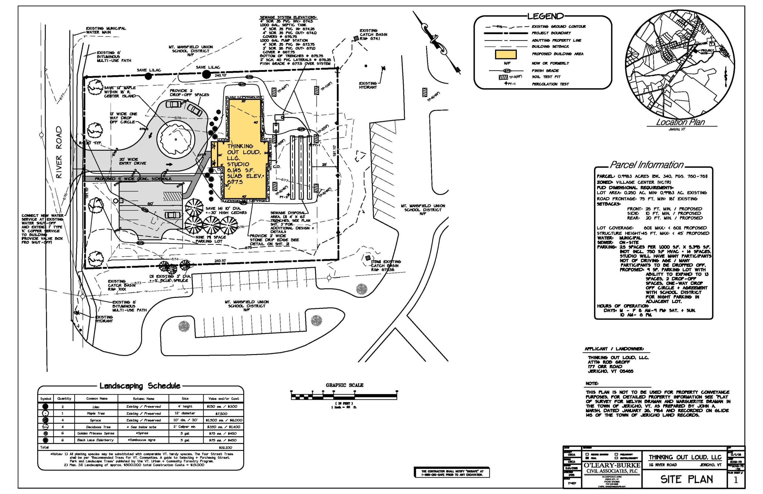
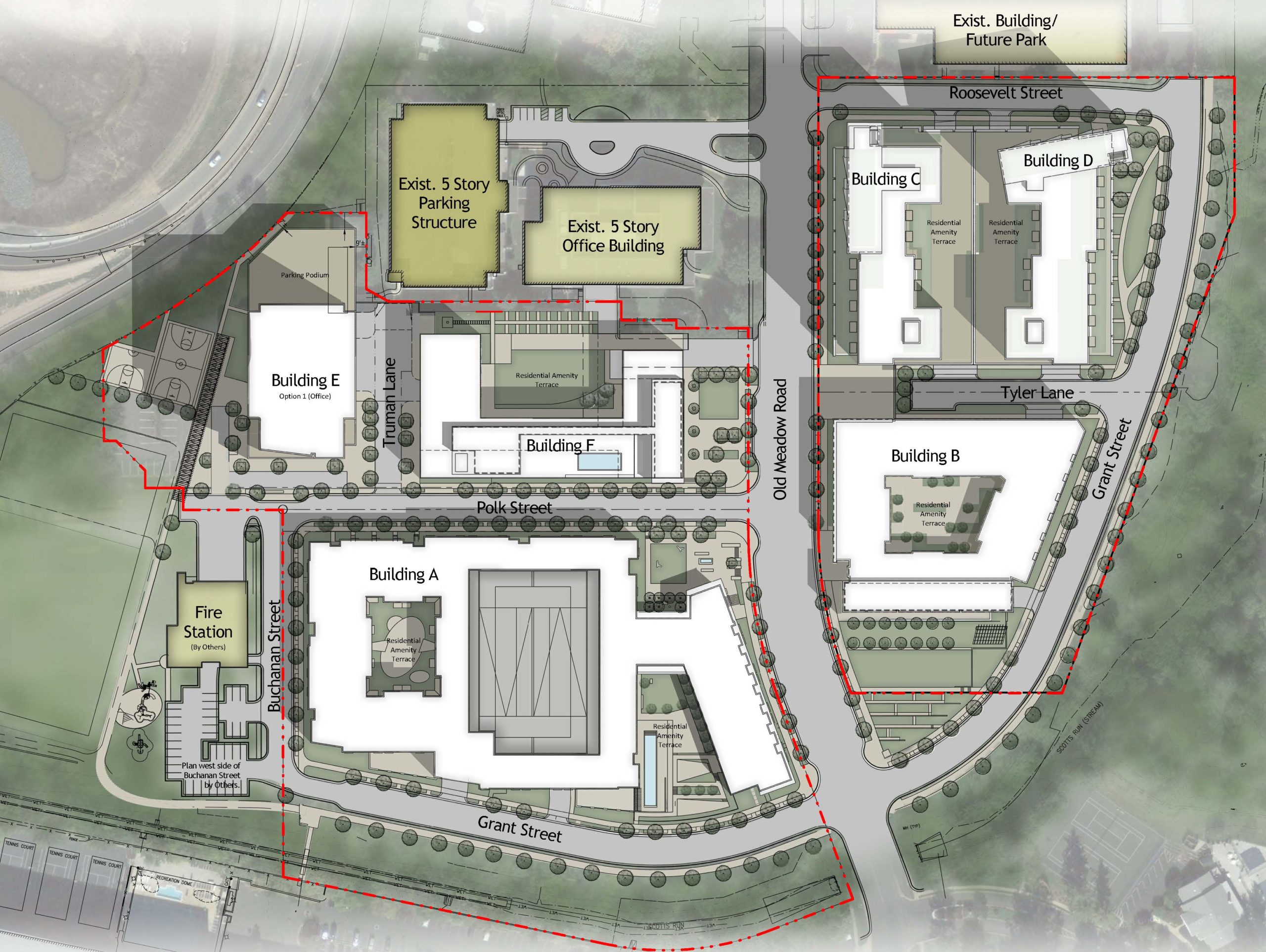
To put it simply, a site plan is a detailed architectural or engineering drawing, whose sole purpose is to show and provide reference to proposed site improvements. Site improvements can include the proposal of buildings and structures, infrastructure, landscaping, re-striping and paving, right-of-way modifications, etc.
Who Can Create Site Plans
Well, any of us can create a site plan for the heck of it, but most municipalities only intake and approve final site plans that are designed and drafted by licensed architects, landscape architects, and engineers. But, I want to reiterate that conceptual site plans can be drawn by anyone, but once you get to the final site plan step in the approval process, the site plan will need to have an engineer seal/stamp or be signed by a licensed architect. Please note that a designer is not the same as a licensed professional.
Difference Between a Plot Plan and Site Plan
The term plot plan and site plan are often used interchangeably; and for the most part they are the same when it relates to the information that is shown on both drawings. So you may be asking, okay well if they are the same then why are there two different terms? Well, there is a slight difference between a plot plan and site plan. The difference lies in that a plot plan is a micro-representation of a site plan. I know, I know you are still puzzled, but let me break this down.
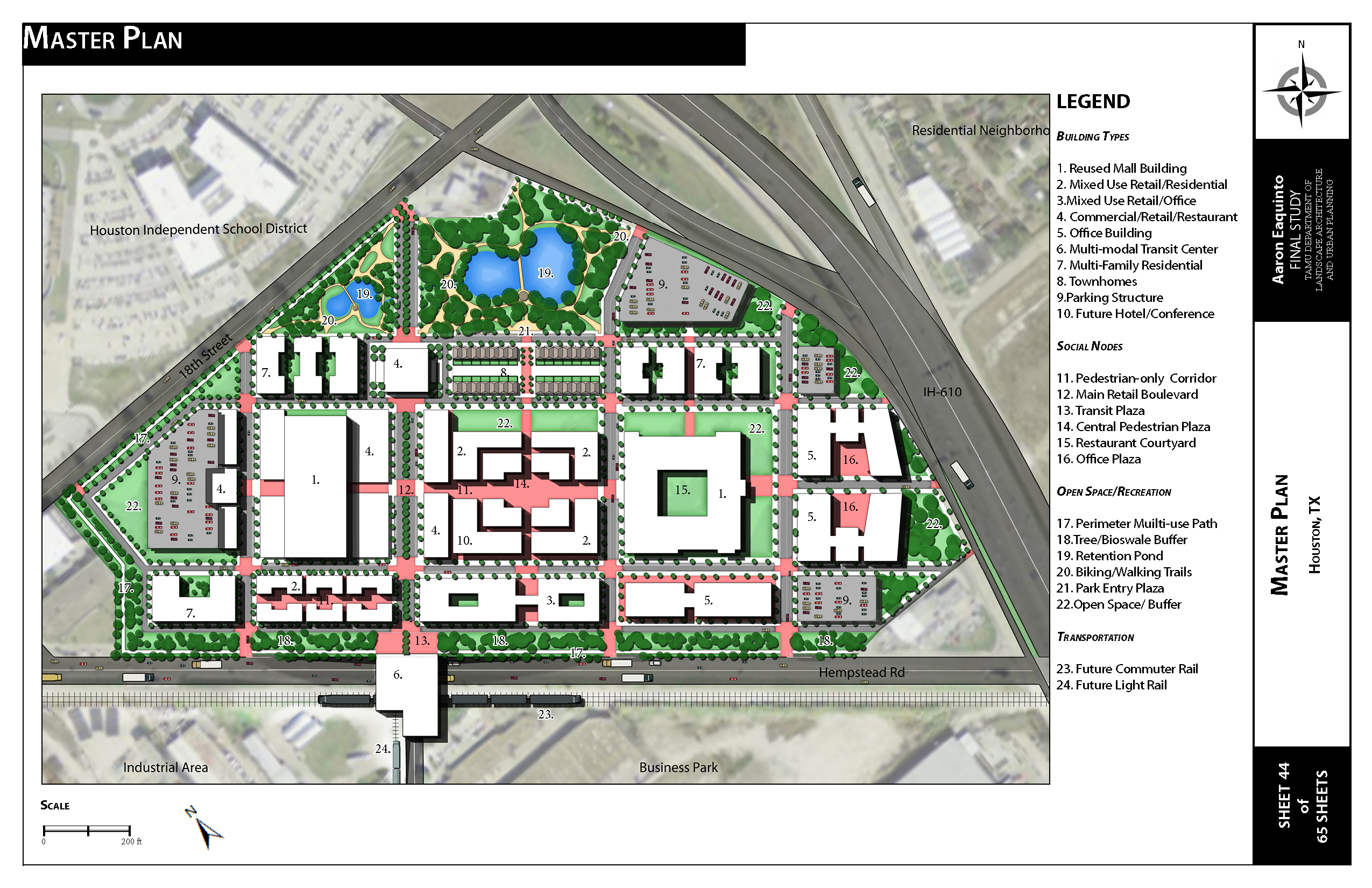
A plot plan is an architectural map that is generally used to provide reference for a single-family parcel of land whereas a site plan will be utilized for commercial, industrial, or multifamily proposals. Another difference is that a plot plan can be drawn by me or you and a municipality will intake the plan and approve it, whereas a final site plan as stated above must be drawn by a licensed architect or engineer. Lastly, a site plan will provide a significant amount of site details whereas a plot plan will provide general details. So just remember, plot plans are for residential single-family lots and site plans are for much larger, more comprehensive, and more complex land use projects such as a 25 acre mixed-use commercial and retail development.
What Information Should be Shown on a Site Plan
Now, that we have the general information out of the way let us get to the meat and potatoes of this blog and that is what should be on a site plan. We will begin with the base information that should be on a site plan whether it is for a commercial, multifamily, industrial, or a subdivision plan.
General Information to be on a Site Plan
- Name, address, telephone number, and email address of the property owner and design profession (architect/engineer) who prepared the plan.
- Scale, now check with the municipality, but generally an engineering scale is the standard scale to use as opposed to architectural scales. The typical scale to use will be 1-inch = 10-feet through 1-inch = 40 feet. Anything smaller is generally used to show context and reference and the overall site. Please consult the municipality on their rules and regulations regarding scale.
- Vicinity map to provide context and bearings.
- North Arrow to show bearings and location.
- Detailed project description.
- Show the dimensions of the following:
- Parcel/lot boundary lines (tie to street monument). Show lease lines if necessary to the proposal.
- Building and landscape setback lines, plus the distance between buildings and other structures.
- All existing and proposed easements, rights-of-way, with dimensions.
- All existing and proposed off-site improvements. This includes sidewalks, curbs, gutters, transit stop pads, etc.
- All existing and proposed driveways. This is to include driveway widths.
- Site visibility triangles and sight lines at driveways and intersections.
- Adjacent and abutting zoning districts.
- Property address and APN (Assessor Parcel Number).
- Site Acreage and square feet, which should include gross and net data.
- Existing buildings/structures to remain, proposed buildings/structures, with the proposed uses labeled.
- Show all significant natural features such as rock outcroppings, washes, existing trees, etc.
- Show and label all proposed and existing safety curbing and surface materials such as concrete, asphalt, turf, decomposed granite, etc.
- Dimension all landscape islands and parking stalls.
- Show and label all existing and proposed fire hydrants within 300 feet of the project site.
- Legal description.
- Show and label all existing and proposed accessible routes/paths, building entrances, public sidewalks, transit stops, and parking spaces.
- Show and label all existing and proposed above ground and underground utilities. This includes water, sewer, telecom, irrigation, electric, wireless facilities, transformers, light poles, etc.
Additional Information to be Shown on Commercial Site Plans
In addition to the base information listed above, there is additional information that will need to be shown on a site plan for commercial developments.
- Existing and proposed zoning
- Previous entitlement case information (case numbers and applicable stipulations). This can include rezones , general plan amendments, use permits, and variances.
- Development summary information:
- Existing and proposed uses.
- Total square footage of structures/buildings, with the individual square feet of each building.
- Proposed and required maximum lot coverage/F.A.R.
- Proposed and required maximum height requirements
- Proposed phased lines for proposals that will be completed in several phases.
- Proposed wall/fence details with dimensions, materials, and heights.
- Proposed and required setbacks
- Parking calculations per the zoning ordinance or entitlement case stipulations.
- Location of service and refuse areas.
- Site plan general notes. Please check with the applicable municipality planning department to see if they have a copy of standard general site plan notes that they require on site plans. These notes can include one of more of the following:
- Development and use of this site will conform with all applicable codes and ordinances.
- All new or relocated utilities will be placed underground.
- Structures and landscaping within a triangle measured back 10’ from the property line and 20’ along the property line on each side of the driveways entrances will be maintained at a maximum height of 3’.
- Any lighting will be placed as to direct light away from adjacent residential districts and will not exceed one-foot candle at the property line.
- No noise, odor, or vibration will be emitted at any level exceeding the general level of noise odor, or vibration emitted by uses in the area outside of the site.
- Owners of property adjacent to public rights-of-way will have the responsibility for maintaining all landscaping located within the public rights-of-way, in accordance with approved plans.
- All signage requires separate reviews, approval, and permits. No signs are approved per this plan.
Additional Information to be Shown on Multifamily and Subdivision Site Plans
Multifamily and and single-family subdivisions will include the above information, but will also include detailed density calculation information.
Conclusion
There you have it, you are now an expert on site plans. I suggest printing this out and using it as a checklist for when the time comes that you have to review or create a site plan. Remember the more information on a site plan the better because this document will be archived and may be used for future property owners of a parcel to know where easements are, the square footage that was approved, and if an existing building located on site was permitted. Further, the document can be used to clear up misinformation about ownership or responsibility of who is to maintain common use tracts. Lastly, a site plan can be used as evidence is court proceedings.
If you found this blog to be beneficial please let me know by visiting the subscribe page and subscribing to Urban Planning Life, leaving a comment, or by reading another blog. As always if you have concerns please do not hesitate to contact the friendly neighborhood planner at support@urbanplanninglife.com.


